|
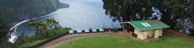
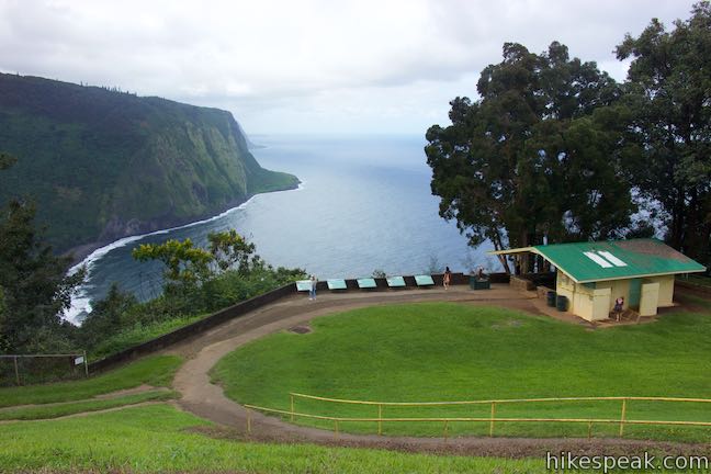
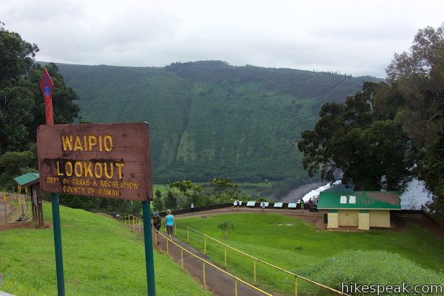
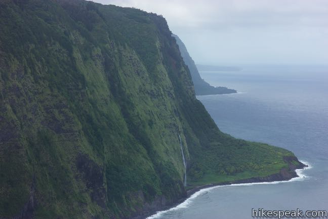
Waipi‘o Valley is a rugged, beautiful, and historic Hawaiian valley on the north side of the Big Island. The verdant valley has a mile long black sand beach framed by steep, thousand foot-tall cliffs. Get a good look at Waipi‘o Valley from a perch at the rim of the valley wall. Waipio Lookout has interesting info panels and impressive views. The lookout is also the launch point for a rewarding hike to Waipi‘o Beach and Muliwai Trail Overlook.
(adsbygoogle = window.adsbygoogle || []).push({});
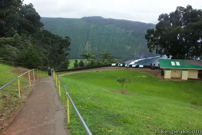
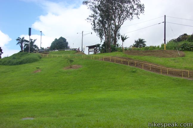
Make your way to the end of Honokaa-Waipio Road on the Hāmākua Coast on the north side of the Big Island of Hawaii. Waipio Lookout (also called Waipi‘o Valley Lookout) has a small parking area off the right side of the road. Straight off the end of Honokaa-Waipio Road, Waipio Valley Road descends toward the valley floor. This rugged, narrow, and super-steep road is for high-clearance four-wheel-drive Vehicles only. Don’t bypass the overlook for this intense drive! From the parking area at the scenic end of Honokaa-Waipio Road, a paved path descends around 65 feet in elevation along a grassy slope. After a 125-yard walk, arrive a collection of info panels that accompany views across Waipi‘o Valley and Waipi‘o Beach. The blue water of Waipi‘o Bay is over 800 feet below. 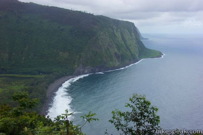
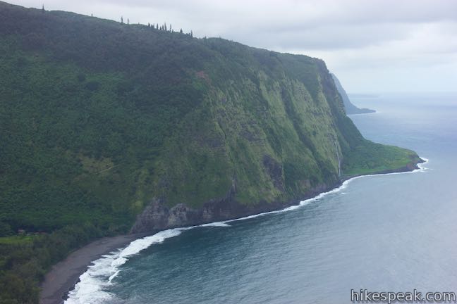
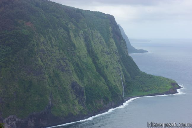
Waipi‘o Beach stretches across the bottom of the valley, with a slightly curved arc of dark sand. While Waipi‘o Beach and the bottom of Waipi‘o Valley are easy to see, most of Waipi‘o Valley is out of view from the lookout. Gaze west across the valley toward rugged cliffs dropping into the Pacific Ocean. Around the north end of the cliffs, you may spot ephemeral Waipahoehoe Falls streaking down the shoreline bluffs. 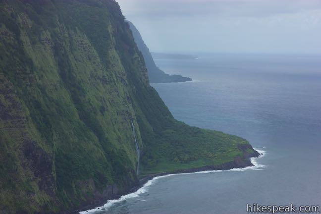
Waipi‘o Valley is known as the Valley of Kings for its regal chapter in Hawaiian history. Waipi‘o Valley was the chosen home of many Hawaiian kings. Nine rules in the Pili dynasty lived in Waipi‘o Valley, including Umi-a-Līloa, who united the Big Island under one ruler. Waipi‘o Valley was also the mythological home of Hawaiian gods like Kanaloa and Kāne. The temple of Pākaʻalana was an important site in the valley. One of the panels describes the valley’s history:
(adsbygoogle = window.adsbygoogle || []).push({});
In 1946, tidal waves changed the valley forever; 55-foot tall waves swept up the valley, destroying temples, both ancient and modern homes, and taro fields. Read the panels and admire the views. If you’re inspired, consider hiking to Waipi‘o Beach and Muliwai Trail Overlook. Otherwise, simply walk back up the path to Honokaa-Waipio Road. Another path by the lookout ventures south over to Waipio Valley Road (which could be taken to hike down to Waipi‘o Beach). The short walk to Waipio Lookout is 0.15 miles round trip with 65 feet of elevation change. Pets are not allowed at Waipio Lookout. Parking beside Honokaa-Waipio Road is free and no permit is required to visit Waipio Lookout, so get out and enjoy! 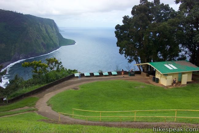
To get to Waipio Lookout: From Waimea, take Hawaii 19 east for 13.5 miles. Turn left on Plumeria Street and drive 0.6 miles down to the town of Honakaa. Turn left onto Mamane Street, which becomes Honokaa-Waipio Road (Hawaii 240). Drive 8 miles to Waipio Lookout at the end of the road. From Hilo, take Hawaii 19 northwest for 39.5 miles. Turn right onto Honokaa-Waipio Road (Hawaii 240), following signs for Honokaa and Waipio. Drive another 9.5 miles to Waipio Lookout. Lookout address: Waipio Lookout, Honokaa-Waipio Road, Kukuihaele, HI 96727 Use the map below to view the overlook and get directions:
(adsbygoogle = window.adsbygoogle || []).push({});
Photos
These photos were taken in October of 2018. Click to enlarge.
Nearby Trails
from https://www.hikespeak.com/attractions/waipio-lookout-waipio-valley-hawaii/
0 Comments
Waipi‘o Valley is known as the Valley of Kings for its regal chapter in Hawaiian history. You’re bound to feel high and mighty while looking across this remote valley and its pristine beach from a panoramic perch on Muliwai Trail. Waipi‘o Valley has steep, thousand foot-tall cliffs, so entering the valley is no simple stroll. Cross Waipi‘o Beach and visit Muliwai Trail Overlook on a 4.88-mile round trip hike that has climbs on each side of the valley that total 1,300 feet of elevation gain. Waipi‘o Valley is a special place for an extra Hawaiian hike.
(adsbygoogle = window.adsbygoogle || []).push({});
Waipi‘o is a deep valley on the Hāmākua Coast on the north side of the Big Island of Hawai‘i. Muliwai Trail starts on the west side of Waipi‘o Valley and travels 7.7 miles to Waimanu Valley, crossing several smaller valleys en route. Muliwai Trail is too long and arduous for a day hike, but you only need to hike 1/3 of a mile up the trail to Muliwai Trail Overlook for a worthwhile outing. To get to Muliwai Trail Overlook, hikers need to descend into Waipi‘o Valley and cross Waipi‘o Beach to Muliwai Trailhead. The itinerary is as follows:
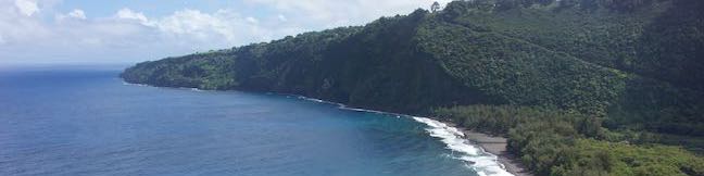
To get started, make your way to the very end of Honokaa-Waipio Road where Waipio Lookout (Waipi‘o Valley Lookout) has a small parking area off the right side of the road. Straight off the end of Honokaa-Waipio Road, Waipio Valley Road begins a determined descent from the rim of the valley down to its floor. Waipio LookoutBefore getting underway, the first thing to do is to check out Waipio Lookout. A paved path from the parking area descends to a collection of info panels accompanying views across Waipi‘o Valley and Waipi‘o Beach. Gaze east across the valley toward rugged cliffs dropping into the Pacific Ocean. Look closely at the imposing, verdant cliffs on the far side of the valley to spot Muliwai Trail zigzagging up the side. To the right of the trail, around the end of the ridge, you may spot ephemeral Waipahoehoe Falls streaking down the cliffs to the shoreline.
The info panels explain that Waipi‘o Valley was the chosen home of many Hawaiian kings. Nine rules in the Pili dynasty lived in Waipi‘o Valley, including Umi-a-Līloa, who united the Big Island under one ruler. Waipi‘o Valley was also the mythological home of Hawaiian gods like Kanaloa and Kāne. In 1946, tidal waves changed Waipi‘o forever – picture 55-foot tall waves sweeping up the valley – destroying temples, both ancient and modern homes, and taro fields. Taro is the most important Hawaiian crop. Leave Waipio Lookout and take the path to the south, which bridges a short distance to Waipio Valley Road. Reach the pavement and turn right down the Waipio Valley Road. Waipio Valley RoadWaipio Valley Road is poorly paved, narrow, and extremely steep. The road drops 850 feet in 0.83 miles and is restricted to high-clearance 4-wheel drive vehicles. The road’s average grade is 25% and some stretches pitch down to a 40% grade. Driving into Waipi‘o Valley is not recommended for those who aren’t familiar with the road or don’t have appropriate vehicles. Many rental car agreements prohibit traveling down Waipi‘o Valley Road. As the road is only meant to serve valley residents and guest, hikers should plan to set out from the top of Waipi‘o Valley Road and hike down. Waipio Valley Road is quite a roadway. Cars have the right-of-way, so hikers need to stick to the side of the road away from vehicles. Descend swiftly to a horseshoe bend to the right. A fork of the road parts to the left from the outside of the bend. Stay to the right to continue down Waipio Valley Road. Coming out of the bend, the views start to open up across Waipi‘o Valley. 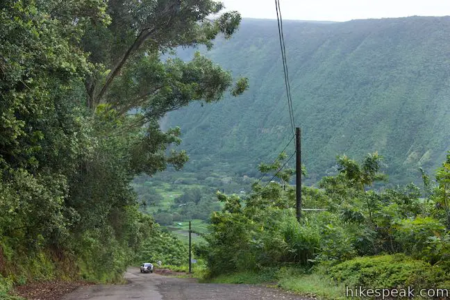
Continue down the no no-nonsense road, angling down the side of the valley. The unrelenting road uncovers nice valley views. Keep in mind that you will have to hike back up this road at the end of the day, so be sure to save some energy, water, and snacks. Don’t overcommit yourself. Waipio Valley Road is one extremely steep road! Keep traveling down into Waipi‘o Valley. As you descend, Wailoa Stream grows more prominent, traveling across the valley floor toward the beach. During rainy months, a half dozen ephemeral waterfalls stream down creases on the west side of the valley. 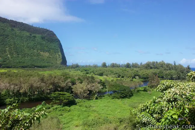
After 0.9 miles of hiking (including the initial exploration off Waipio Valley Road to Waipio Lookout), come to the bottom of the valley wall where the road hits an intersection. To the left, a road heads into more private areas up Waipi‘o Valley. Resist the urge to get closer to Hi‘ilawe Falls and treat this road as through it is off limits. Turn right to head toward the coast. It should please you to discover that the road ahead is nice and level. Indeed, there is little elevation change over the next 1.25 miles on the road and beach. After turning right at the T-intersection at the bottom of Waipio Valley Road, stay to the right on the rutted dirt road as it passes a driveway on the left. A sign along the road reads, “road closed due to unsafe conditions – property owners will not be held responsible for any injuries and/or damages that may occur.” Make your way up the road past wetlands along Wailoa Stream. The trail passes through forest at the base of the valley wall. Although level, the dirt road has many mud puddles for you to dance around (or through). Feral horses live throughout Waipi‘o Valley. You are likely to cross a few horses along the road or at the beach. The horses seem to either ignore humans or act friendly in search of food. A tenth of a mile before the end of the road, stay to the right past another drive that branches off to the left. The more-traveled road is obvious. Soon after that, come to the edge of the forest behind Waipi‘o Beach. The road basically ends here (1.4 miles from the start of your adventure), but jeep trails extend to the right and left toward parking spaces behind the beach. 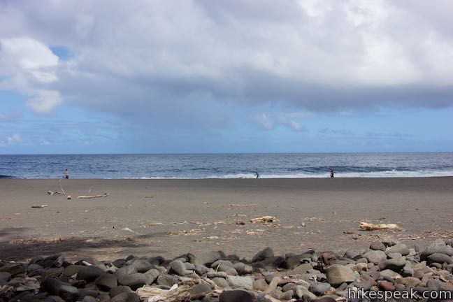
Waipi‘o BeachWaipi‘o Beach is a north-facing beach that is nearly a mile long. The road ends by the east side of the beach. Muliwai Trail starts from the west end of Waipi‘o Beach, so fortunately for you, the next leg of the trek is to walk 3/4 of a mile across the beach. 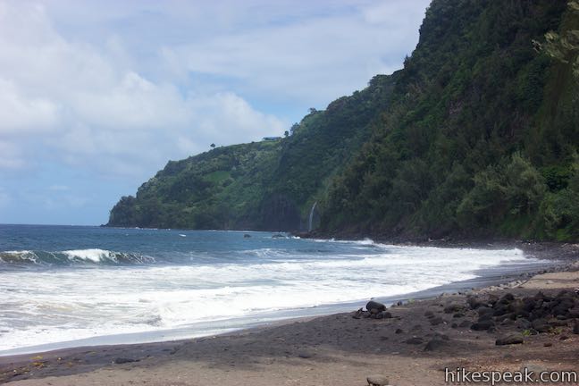
If you turned right at the end of the road, instead of heading west, you’d find that the beach continues for another 0.2 miles, becoming very rocky as it meets cliffs at the east edge of the beach. For another Waipi‘o adventure, visitors can trek half a mile along the rocky coastline to the spot where Lakuahine Falls tumbles down the cliffs to the ocean. During high tide or rough surf, do not attempt to cross the boulders along the way to Lakuahine Falls as it can be too dangerous. To get a perspective of Lakuahine Falls, it is actually easier to head west along the beach, away from the waterfall, allowing it to peak out from behind the cliffs and come into view. 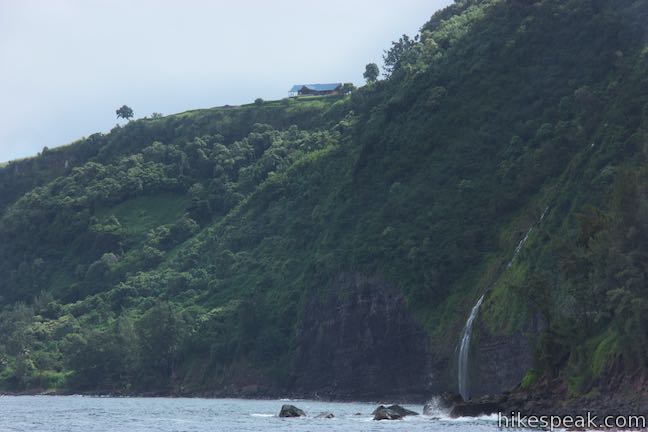
Bear left at the end of the road and walk either across the beach or on paths through the trees just behind the sand. Portable toilets (of unreliable cleanliness) are located in the forest near the end of the road. Waipi‘o Beach is quite a place, with almost a mile of welcoming black sand stretched out between towering cliffs. The coastline is undeveloped and gorgeous. The ocean may not be an inviting place to swim, however. Particularly when the surf is rough, the rip current can be quite dangerous. Do not swim or surf without experience in these conditions. Walk west along Waipi‘o Beach for 300 yards to an interruption in the sand. Wailoa Stream flows across the beach and into the ocean. No bridge crosses the stream, so you will need to wade across to reach the rest of the beach. Depending on the levels of the stream and the tide (and also your height), you’ll need to wade in up to your thigh or your waist to cross Wailoa Stream. The crossing can be difficult after major rainstorms and during high surf, so proceed only when safe. 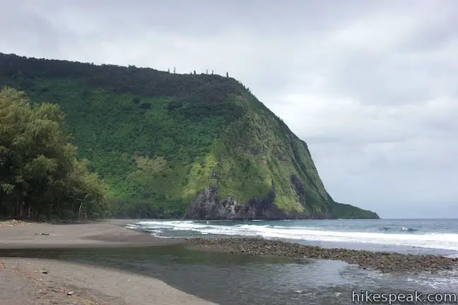
Wear water shoes to cross Wailoa Stream, or just go barefoot or in flip-flops. The water in Waipi‘o Valley is known to contain leptospirosis, a sickening bacteria, so do not drink any of the water or make contact with the stream with open cuts. While you might share the east side of Waipi‘o Beach with a few parties of people, the rest of the beach should feel more secluded. The creek crossing provides enough of a barrier that you could have the rest of Waipi‘o Beach mostly to yourself. From the far side of Wailoa Stream, you have a couple ways to get to Muliwai Trail: Route 1) If beaches aren’t really your thing, or if you prefer hiking on firmer ground (because you’re wearing a heavy pack, for example), find a path entering the woods on the left. Connect to a jeep trail that heads west through ironwoods, firs, and fern trees in the forest just behind the beach. The trail has gently rolling terrain and passes through lots of vegetation. The partially shaded trail runs parallel to the beach. When the beach ends, the trail turns inland (left) along the side of the valley around Muliwai Pond, coming to a marked junction at the bottom of Muliwai Trail. 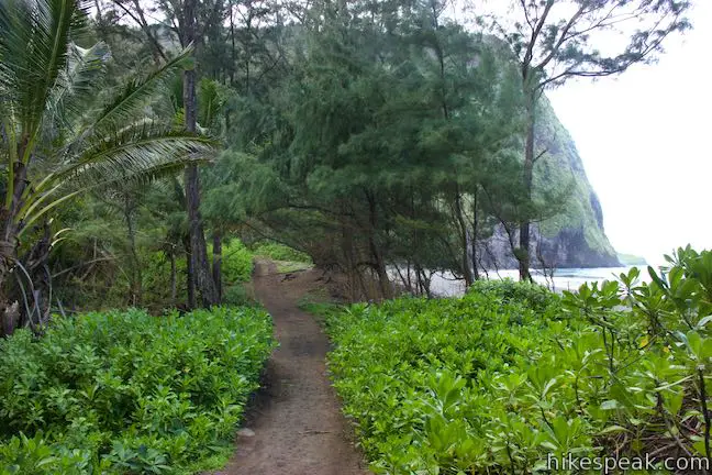
Route 2) The more obvious and more enjoyable route is to simply walk up the beach until you can’t go any farther. Waipi‘o Beach is fun to explore. Sink your toes into the black sand. Look out across the ocean, which fills the horizon. Over your shoulder, Lakuahine Falls pours down the cliffs on the east side of Waipi‘o Bay. Straight ahead, the tall cliffs at the end of the beach look imposing, but are not inaccessible – because of the faint line of Muliwai Trail that zigzags up the valley wall. You may notice hikers standing at the end of a switchback straight above the beach. That is the overlook destination for this hike. Out around the west side of the cliffs, the coastline has a magical untouched quality. When the water is flowing, the white ribbon of Waipahoehoe Falls courses off the cliffs toward the coast. 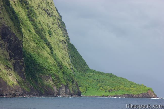
Large driftwood tree trunks are strewn across the back of the beach. Some act as nice benches, should you wish to take a break. In the fall, ripe guavas fall from the trees in Waipi‘o Valley and get carried to the ocean by Wailoa Stream. The fruit washes up on the beach like little yellow balls of driftwood. Instead of walking straight into the cliffs at the west end of the beach, bear left and head toward the trees. Meet the trail that runs behind the beach and follow the trail into the forest toward some cabins. Before the beach is even out of sight, you’ll come to a marked junction at the bottom of Muliwai Trail. 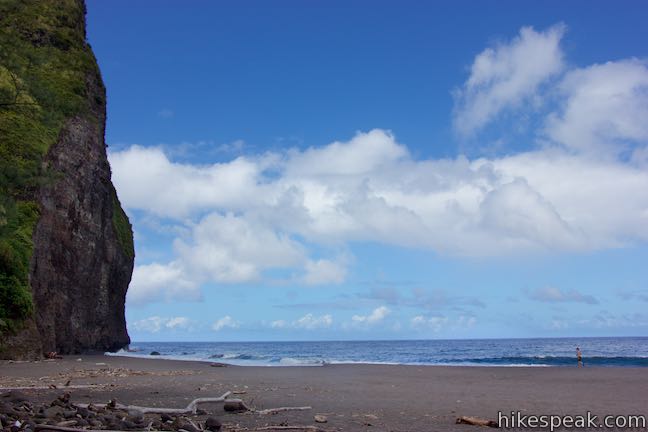
Muliwai Trail (a.k.a. Waimanu Trail or Z-Trail)From Waipi‘o beach, it is a short walk inland along the west side of Waipi‘o Valley to the junction with Muliwai Trail. As of 2018, the signs for the trail read Waimanu Trail, which makes sense because the trail leads to Waimanu Valley, but the trail is officially known as Muliwai Trail. To complicate the naming game, the stretch of the trail up the wall of Waipi‘o Valley is also called the Z-Trail because of its dramatic switchbacks, visible from a distance. Turn right onto Muliwai Trail and start the climb. Pass a sign at the boundary of the Muliwai Section of Kohala Forest Reserve. Trees hang over the trail, so much of the ascent is shaded. The steepness of the trail is made tougher by the valley’s heat and humidity, so it can feel refreshing to catch breezes once you rise above the trees (the bold views are invigorating too). After turns to the left, right, and left (three switchbacks), the trail leaves the forest for shorter brush and grasses that sprout from the sheer valley wall. After 0.2 miles on Muliwai Trail, things open up for a grand perspective over Waipi‘o Valley that will stop your in your tracks. 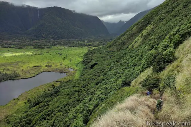
If you liked the views from Waipio Lookout, you’ll love what Muliwai Trail has to offer – basically the opposite perspective across Waipi‘o Valley. Muliwai Trail boasts a significantly broader vantage up the valley. Looks south over wetlands and fields that transition into a tropical rainforest wedged between steep green walls. On the west side of the valley below the trail, kidney-shaped Muliwai Pond offers a glistening reflection of the sky. 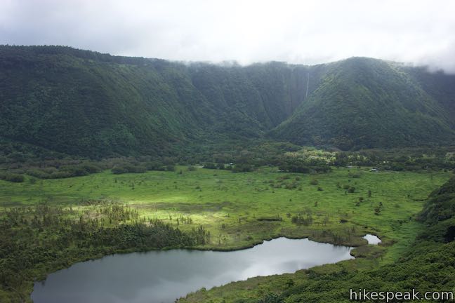
Along the east wall of Waipi‘o Valley, Hi‘ilawe Falls drops approximately 1,450 feet, including a 1,200-foot single fall from the valley wall. The beautiful waterfall is on private land and not accessible by trail, so this distant view is one of the best ways to see Hi’ilawe Falls. The bottom of Hi‘ilawe Falls is shielded from view by a slope on the valley wall. 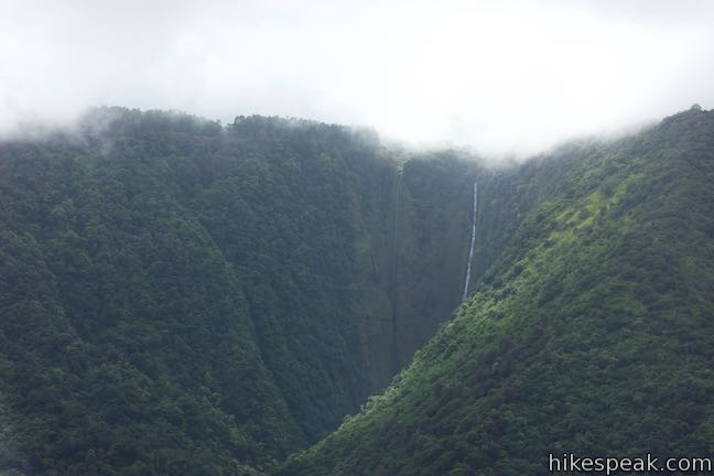
The vistas expand over the next eighth of a mile. The trail is steep, rocky, and narrow. Any time you need to catch your breath, just pause and enjoy the sweeping surroundings. The drop-offs on the right side of the trail are precipitous, so watch your step. Muliwai Trail OverlookAfter a third of a mile of climbing, Muliwai Trail comes to another sharp switchback (living up to it’s Z-Trail nickname). Off the right side of the trail, find an obvious, but unmarked, vista point. Step out and take in some spectacular sights. Waipi‘o Beach is below, stretching east and curving gently to the left. Look farther up the coastline to see Lakuahine Falls cascading down the cliffs toward the ocean. Waipi‘o Bay is laid out below you, cradling gorgeous blue water. To the right, look over ponds and streams surrounded by the greenery of Waipi‘o Valley. Hi’ilawe Falls is in view as well (which is why this spot can also be called Hi‘ilawe Falls Overlook instead of Muliwai Trail Overlook). This lookout offers a lot to look at! 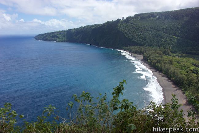
(adsbygoogle = window.adsbygoogle || []).push({});
Are you the type of person who visits a spectacular tropical valley and wonders what the next valley over looks like? The rest of Muliwai Trail may be for you! After more switchbacks on the side of Waipi‘o Valley, the trail crosses a series of ridges and gulches before dropping into Waimanu Valley, which looks a lot like Waipi‘o Valley but is even less developed and has a beach-adjacent campground for backpackers. Muliwai Trail is 7.7 miles long and super tough. Unless you’re making this hike into an overnight (permit required), the early lookout is a good place to turn around. You might chose to climb another 800 feet up the next Z in Muliwai Trail to reach the rim of Waipi‘o Valley and even bigger views. However, be sure to dose your efforts, because after coming down Muliwai Trail and crossing Waipi‘o Beach, a final workout awaits in the 850-foot ascent on Waipio Valley Road. The hike backAfter enjoying all the views, turn around and head down Muliwai Trail. Cross the valley by either walking back across Waipi‘o Beach or taking the trail through the trees behind the beach. Wade through Wailoa Stream and cool off your lower half in the rushing water. You’ll probably want to linger on Waipi‘o Beach for a while before leaving. Trek back up the dirt road along the east side of the valley for half a mile to the intersection below the climb. Turn left and ascend 850 feet in the final, grueling 0.83 miles up to Honokaa-Waipio Road beside Waipio Lookout. 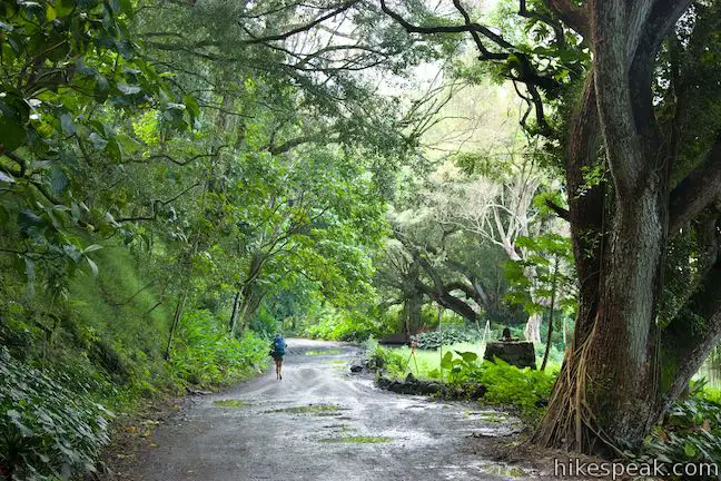
Waipi‘o Valley is beautiful and historic. Be respectful of the valley as you hike. Garbage collection is not provided, so pack out anything that you carry in. Pets are not allowed at Waipio Lookout, but dogs do seem to be allowed at Waipi‘o Beach. Bikes can be used on the roadways (but would you want to). No permit is needed to enter Waipi‘o Valley and day hike on Muliwai Trail. Permits are required for overnight stays at the campground in Waimanu Valley. Camping is not allowed at Waipi‘o Beach. Parking at the trailhead is free but limited (observe all street signs). The turn-by-turn directions for this hike are:
To get to the trailhead: From Waimea, take Hawaii 19 east for 13.5 miles. Turn left on Plumeria Street and drive 0.6 miles down to the town of Honakaa. Turn left onto Mamane Street, which becomes Honokaa-Waipio Road (Hawaii 240). Drive 8 miles to Waipio Lookout at the end of the road. From Hilo, take Hawaii 19 northwest for 39.5 miles. Turn right onto Honokaa-Waipio Road (Hawaii 240), following signs for Honokaa and Waipio. Drive another 9.5 miles to Waipio Lookout. Trailhead address: Waipio Lookout, Honokaa-Waipio Road, Kukuihaele, HI 96727 from https://www.hikespeak.com/trails/waipio-valley-beach-hike-muliwai-trail-hawaii/
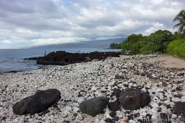
While much of Hawaii’s coastline is understandably built up with vacation destination resorts, some areas have a wilder feel, like Kīholo Bay. Driftwood decorates the rugged coastline, just 25 miles north of Kona, and green sea turtles ease through the bay’s cyan-colored shallows. The Hawaii State Parks website describes Kīholo State Park Reserve as:
Experience the park on a two-mile round trip hike across a rocky shore, passing coves and beaches that lead to the turquoise water of Wainanali’i Lagoon. This lovely locale has a unique history – built into fishponds by Hawaiians prior to a landscape-redefining 19th century lava flow. Additional hiking in the park includes a 1-mile round trip outing down the coast in the opposite direction to a black sand beach.
(adsbygoogle = window.adsbygoogle || []).push({});
Start from a parking area at the end of a 1-mile long dirt road that descends to the coast from Hawaii 19, the main route north of Kona. Off the circle at the end of the road, find a wide trail crossing pahoehoe lava rock that pushes through an airy forest of kiawe trees for thirty yards to arrive at the coast. Ahead, the volcanic surface stretches into the ocean like black fingers, forming tide pools with their touch. Unless you’re heading to the black sand beach, half a mile to the left, bear right to make your way toward Wainanali’i Lagoon. A well trodden path passes through an archway in the trees. The route becomes less defined as you go. Because most of the trek to Wainanali’i Lagoon is not on an established trail, the hiking can be rough and slow-going. Budget extra time for your visit. 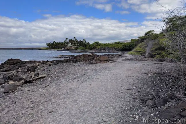
After 1/8 of a mile on the coast, look on your right for rocks that mark the site of Keanalele (also known as Queen’s Bath), a lava tube cave just below the surface. Openings in the crust of pahoehoe lava reveal a pool of freshwater mixing with saltwater in a tunnel just underground. Have a look, but stay out; swimming in this pool or any cave in Kīholo State Park Reserve is not permitted. Continue walking northeast along the coast. As you go, enjoy views north over Kīholo Bay toward the slopes of Kohala. Soon afterward, and a quarter mile from the start, curl around the back of a partially sheltered cove. This is an easy spot to snorkel, if you’re eager to take a break and cool off in the ocean. Walk up the coast past more tide pools. Cross a trail on the right that heads inland and connects to a road (which could be used to make a less scenic loop back to the trailhead). Keep on moving up the coast, where signs of a defined route lead to a picnic table atop a gravely beach. Just behind this beach is a large yellow building wrapped by coconut trees, one of the private holdings within the reserve. The picnic table is 0.4 miles from the trailhead and makes a decent early turnaround point for those who tire of trudging up the rocky shoreline. 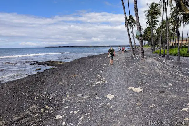
Moving along, the path disappears, so forge your own route. Since your feet sink deeper into the rocks and sand than they would on a hard-packed trail, this two-mile hike may actually feel like double the distance because of the extra effort. If your legs get soar, simple stop and gaze out over the beautiful bay. 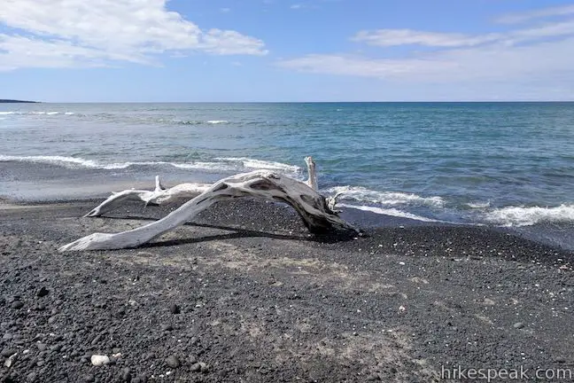
Shortly after the first property, spot a second retreat constructed in an impressive Balinese style. A bench here could be used to take a break. Aside from a few sandy stretches, the coast remains rocky as you continue north. Arrive at a round point, 3/4 of mile from the start. The most recessed part of Kīholo Bay is to your right, hosting a short black beach. Across from the point, spot the small island and long peninsula framing Wainanali’i Lagoon. The blackened landscape of a not-so-old lava flow meets the far side of the bay. 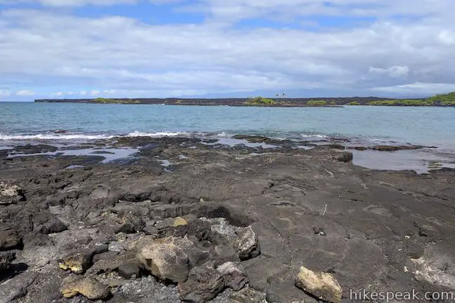
About 200 years ago, this view would have looked very different. Early in the 19th century, Kamehameha I, the first ruler of the kingdom of Hawaii, took advantage of the freshwater flowing into the bay and had an ambitious 6-foot tall, 20-foot wide seawall built to enclose a grand fishpond with a 2-mile circumference. A village stood next to this large-scale fish-farming operation. In 1859, a 300-day long eruption on Mauna Lau channeled molten lava to the coast, destroying the village and reshaping the fishponds and shoreline. Instead of being enclosed by a wall, water and marine life now flow freely around a small island and a long peninsula that partially enclose Wainanali’i Lagoon. 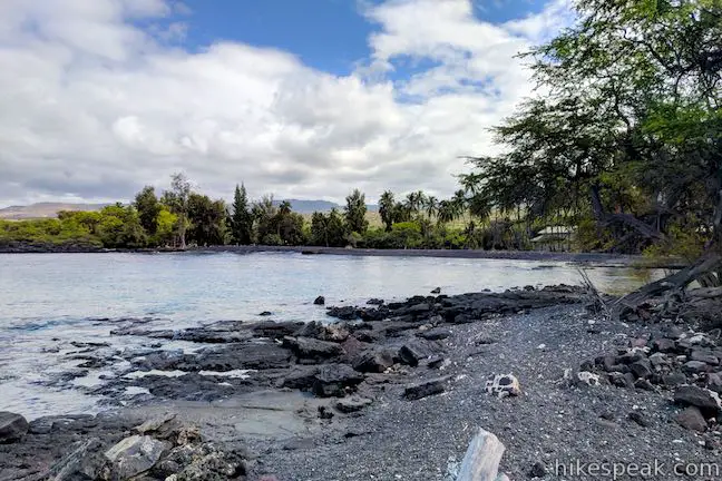
Proceed past the point and walk around the back of the bay across the beach. Use a short bridge to cross a stream flowing into the bay that connects to privately-owned fishponds just inland. On the far side of the beach, make your way to the edge of Wainanali’i Lagoon. The turquoise pool is so inviting, you may be compelled to swim – or at least stand and watch the fish and sea turtles (honu). 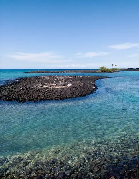
The peninsula-shielded lagoon has calm clear water. The mixture of freshwater and ocean water in Wainanali’i Lagoon accounts for the vivid turquoise color, which is lighter than the rest of Kīholo Bay. Snorkelers are sure to see a splendid variety of tropical fish. The sea turtles have dibs on the lagoon, like the rest of Kīholo Bay, so give them plenty of space when you are on land and in the water. (It is illegal to approach the sea turtles.) Wainanali’i Lagoon is about one mile from the trailhead. You could explore farther or swim for hours. Either way, return by the same route when it is time to leave.
(adsbygoogle = window.adsbygoogle || []).push({});
Kīholo Bay Black Sand BeachAt the end of the path from the parking area to the coast, if you look to the left, you’ll spot a black sand beach. To reach it, just walk a half-mile down the shore. A pool behind the beach, called Waia’elepi can be observed but is not open for swimming. Dogs are not allowed in Kīholo State Park Reserve. The coast is not suitable for bikes. The park is open from 7 a.m. to 7 p.m. from April through Labor Day and from 7 a.m. to 6 p.m. during the rest of the year. A camping area near the trailhead is open from weekends only. Sites are $12 per night (as of 2018) and may be reserved in advance on the state parks website. No permit is required to hike in Kīholo State Park Reserve and parking at the trailhead is free, so get out and enjoy! The dirt road down to the trailhead from Highway 19 is somewhat rough, so high clearance vehicles are recommended. To get to the trailhead: From Kona, travel north on Hawaii 19 (Queen Ka’ahumanu Highway). Pass Keahole Airport Road and go another 11 miles to a scenic overlook for Kiholo Bay on the left (makai side of the road). Take the turn lane to pull into the scenic overlook. Then pull back out onto Hawaii 19 and drive 0.4 miles southwest (in the opposite direction). Turn right down the first dirt road, which is unmarked. Drive 1 mile down this road to a trailhead parking area. Stay straight past roads on the right and left that come around 0.8 miles from Hawaii 19. Coming from Waimea, it is a 25 miles southwest to the Kiholo Bay Scenic Overlook just before the turnoff for the road to the trailhead. Trailhead address: Kiholo Bay Parking, Kīholo State Park Reserve, Queen Ka’ahumanu Highway, Kailua-Kona, HI 96740 from https://www.hikespeak.com/trails/kiholo-bay-wainanalii-lagoon-hike-hawaii/
A list of things for hikers to do on the Big Island of Hawai’i includes: walking across a lava field, exploring a cave, looking for petroglyphs, seeing fishponds created by early Hawaiians, and taking a time-out by tide pools in a beautiful bay. Check off everything on that list with one visit to Kalahuipua’a Historic Park and Fishpond Preserve. A loop around coastal Kalahuipua’a Fishponds connects to the end of Kalahuipua’a Trail to form a lollipop loop hike that is 1.7 miles long with just 30 feet of elevation change. This easy and varied hike has something new to experience around almost every turn.
(adsbygoogle = window.adsbygoogle || []).push({});
Kalahuipua’a Historic Park is located beside the Mauna Lani Resort on the west coast of the Big Island of Hawai’i, 25 miles north of Kona. From a trailhead parking area with bathrooms and picnic sites, set out on a paved trail that rises onto a pahoehoe lava field. (Pahoehoe is the smoother type of lava that looks like hardened batter.) Kalahuipua’a Trail crosses an ancient lava flow where minimal vegetation has yet to take hold. Follow the trail’s weaving path past a few informative panels. The first panel is located in front of a collapsed area in the ground by the trail. The panel describes how lava tubes channel eruptions of pahoehoe lava:

Continue a little farther to another sign that describes woodworking tools made by early Hawaiians out of the volcanic rock. Hawaiians (including royalty) lived in this area for 800 years before the islands were discovered by westerners. After this sign, the trail makes a big curve to the left and dips toward some short trees. As the trail curves back to the right, look for a path branching of to the left toward a cave below a shelf in the lava. The spot where the footpath leaves the paved trail is not marked with a sign, but you should be able to spot a couple panels in front of the cave to reassure you that this is the right spot to leave the pavement. 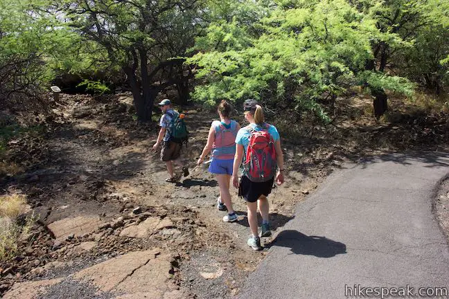
At 0.2 miles from the start, stray off Kalahuipua’a Trail on the short path to the opening of a lava tube below the volcanic surface. Archeologists have scoured the cave and found evidence of early Hawaiians using the cave as a a shelter from AD 1500 to 1700. One panel explains:

Step into the lava tube and imagine how it might have appeared with these Hawaiians gathered inside. Stagger across the floor of the lava tube shelter, which is covered in a rubble of rocks that have fallen from the ceiling of the cave. Stand below an opening in the middle of the cave and look up toward the sky. Smaller openings leak light into different corners of the cave, making it easy to have a look around without a flashlight (although you might want to bring one). 
When finished exploring the lava tube shelter, step out into the light. Take the path back to Kalahuipua’a Trail and turn left to continue along the paved trail. Kalahuipua’a Trail crosses more of the lava field beside the Mauna Lani Resort. Just before the end of the trail, a rock-lined path ventures to the left. Amble a short distance up this path and see if you can find petroglyphs carved into the volcanic surface.
Continue on Kalahuipua’a Trail, which swiftly comes to an end, 0.35 miles from the start. Cross a road onto a wide paved trail leading to the first fishpond. Look left into Hope’ala Fishpond, a shallow emerald pool that is one of the seven fishponds preserved around the resort. 
Walk 125 yards farther up the trail to a junction where the loop begins. Though you can head in either direction, the route described here suggests continuing straight (staying to the right). Begin hiking the loop in a counter-clockwise direction. Overlook the encroaching resort buildings to the right and keep your gaze fixed across Lahuipua’a Fishpond, the largest pond in the preserve. A panel positioned beside the trail explains how early Hawaiians cultivated and fish-farmed these coastal pools.
The fishpond of Lahuipua’a was once a shallow bay that early Hawaiians walled off and enclosed. The fish growing in the ponds eat algae off the bottoms. By keeping predators out, the fish are able to grow to a size where they can be harvested. (Recreational fishing in these fish farms is prohibited). 
Walk along Lahuipua’a for a tenth of a mile to come to another junction. Kakaiwa Bay is right in front of you. The loop continues to the left, but why not see even more of the scenic coastline and fishponds? Bearing right, the trail becomes unpaved. Make a second immediate right to follow the dirt road past a reproduction of a petroglyph in front of the resort. Enjoy sea breezes as you follow the dirt road north. On your right, spot fish swimming around Waipuhi Fishpond. Look at the hālau structure built along the cove to the left. The dirt road leads to a sand beach. Gaze out across Kakaiwa Bay and look north up the coast toward Kohala and the northwest tip of the Big Island of Hawai’i. Gazing out across Kakaiwa Bay, you may spot land across the sea. That’s the island of Maui, where the white domes of observatories shimmer atop Haleakalā. 
Resist the urge to venture farther up the coast to the north, (or go ahead and explore a little more of the shore in front of the resort). Bear left to curve south around the point. Walk back beside the hālau and admire the wooden frame and roof made of palm fronds. Follow a dirt path around the cove or hop across the rocky tide pools to spot tropical fish like black and yellow striped Moorish idols. Come around the tide pools to a grassy lawn (at the end of the paved trail that you would have reached by turning left and the junction when you approached the coast). Walk across the lawn to a walkway on top of the wall built to separate Lahuipua’a Fishpond from the ocean. This stretch of the hike is lovely any way you look at it. A green palm-wrapped fishpond is to your left, while a turquoise, tide pool-wrapped bay is to your right. 
Along the short sea wall, pass a gate between the bay and the fishpond. The volcanic rock making up the sea wall has pores that actually filter some fresh ocean water into the ponds, but makaha gates were important for circulating water and controlling what fish could come in and out of the ponds, as a panel explains:
(adsbygoogle = window.adsbygoogle || []).push({});
Eels swim around the pool in front of the makaha. Pass a boat launch as the trail leaves the sea wall and becomes a wide gravel road. Approach a resort beach and bear left to stay on the road, keeping Lahuipua’a Fishpond on your left. Come to a junction at the southwest corner of the loop, after a mile of hiking. Turn left, continuing to hug Lahuipua’a Fishpond and passing a blue sign for the “Historic Fishpond Preserve.” Follow the level and palm-lined trail along Lahuipua’a Fishpond, enjoying a nice perspective back toward the sea wall and the coast. 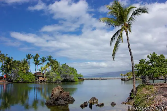
Next, you will hike past the smaller Kaaiopio Fishpond, which is stocked with mullet and milkfish. When you come to another junction (0.3 miles past the previous one), make the obvious left turn to continue on a route through the fishponds. The first pond on the hike, Hope’ala, reappears to your right as you make your way along the last piece of the loop. Meet the junction where the circuit began and bear right. Cross the road to return to Kalahuipua’a Trail and take the paved path back to the trailhead. This lollipop loop hike in Kalahuipua’a Historic Park is 1.7 miles long with 30 feet of elevation change. Dogs and bikes are prohibited. No permit is required for this hike and parking at the trailhead is free, so get out and enjoy! To get to the trailhead: From Kona, drive north on Hawaii 19 for 26 miles. A mile and a half after passing Waikoloa Road, turn left at the traffic light onto Mauna Lani Drive (on the makai side of the road). Drive one mile to a traffic circle and take the second exit (passing straight through the circle), following signs for the Historic Park (not to be confused with signs for the Petroglpyh Park off the first exit of the traffic circle). At the next intersection, turn left onto Pauoa Road. Make the first right, at a sign that reads “Historic Park Shoreline Access” and drive up to a trailhead parking area loop. Trailhead address: Pauoa Road, Puako, HI 96743 from https://www.hikespeak.com/trails/kalahuipuaa-trail-lava-tube-shelter-fishponds-loop-hawaii/
On the Big Island of Hawai’i, Puakō Petroglyph Archeological District is one of the best places to see rock carvings created by early Hawaiians. Malama Trail offers two hiking itineraries:
(adsbygoogle = window.adsbygoogle || []).push({});
Puakō Petroglyph Archeological District (also know as Puakō Petroglyph Park) is located on the west side of the Big Island, about 25 miles north of Kona. Start from a parking area at the end of Holoholokai Beach Park. Find Malama Trail heading inland, instead of (or in addition to) heading west to the beautiful black-and-white Holoholokai Beach covered with black lava and white coral. Malama Trail starts from the northeast corner of the parking area. A sign at the trailhead explains that:
Puakō Petroglyph Archeological District contains 3,000 rock carvings (1,200 of which are visible to visitors), making it the biggest petroglyph area in Hawai’i and, according to Frommers, “the largest rock art site in the entire Pacific.” 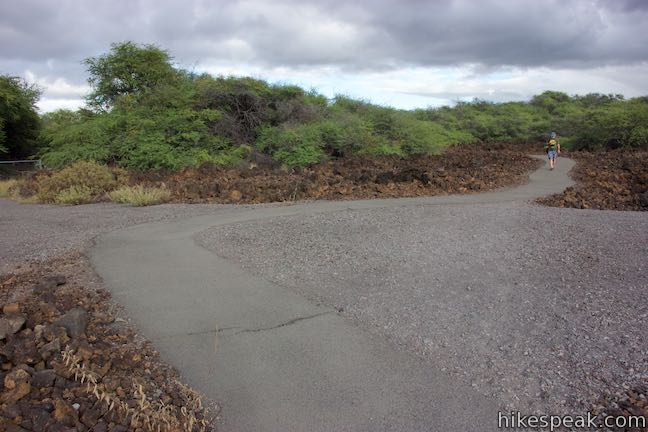
Take the paved trail on a short snaking path to the edge of a forest of kiawe trees. When the pavement ends, it’s time to have a look around. On the right and left sides of the trail, discover gravel areas wrapped by dozens of rock carvings. If these petroglyphs appear to be perfectly displayed for hikers, that’s because… they’re on display for hikers! These carvings are actually replicas of some of the area’s true petroglyphs. The reproductions visitors to look closely at different figures carved into lava rocks. Investigate each carving and interpret the stories that they might tell. 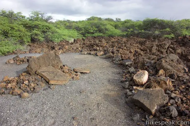
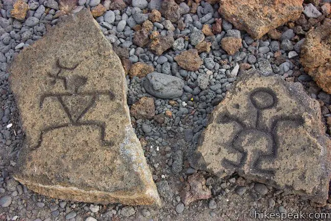
While it is illegal to touch or make rubbings of the historical petroglyphs in the area farther up the trail, these reproductions do not have the same level of protection. The petroglyph reproductions are open for hands-on examination (that young hikers in particular may enjoy). Even through they are replicas, this area of reproduced petroglyphs is quite interesting. For those who turn around when the pavement ends, the result is a 0.2-mile round trip walk with just a few feet of elevation change. Puakō Petroglyph FieldThe real petroglyphs are located another half mile up Malama Trail. Don’t attempt the next section of the trail with flip-flops or other inadequate footwear because the kiawe trees are thorny and the lava rock underfoot is uneven. 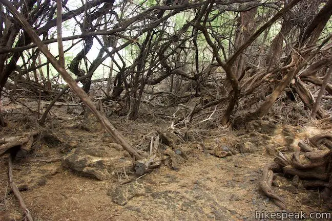
(adsbygoogle = window.adsbygoogle || []).push({});
Beyond the pavement, the trail is engulfed by trees. Make your way through the kiawe forest and across a plane of pahoehoe lava. You will pass a lava cave along the way. Malama Trail is marked with cairns or “ahus” rock mounds. After the trail exits the forest, hike straight through an intersection with a dirt road, one hundred yards before the petroglyph field. Puakō Petroglyph Field is fenced off for preservation, so circle the railing and examine the authentic rock carvings. Spot petroglyphs resembling paddlers, dancers, hunters, anglers, and animals. In the Hawaiian language, petroglyphs are called “kii pohaku,” meaning images in stone. Whether you admire the petroglyphs as works of art or become intrigued by the human history that they embody, you are bound to wonder about the people who carved the petroglyphs and the messages they convey. 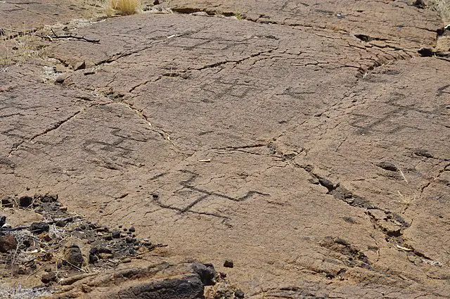
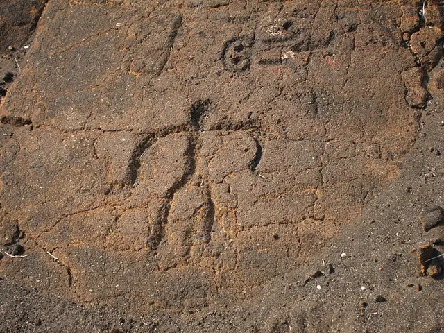
Direct sunlight at midday can make the petroglyphs hard to distinguish. Side lighting in the early morning and late afternoon create better contrast for illuminating the carvings in the rocks. Respect the petroglyphs and obey all fences, boundaries, and preservation rules. After looking over the petroglyph field, hike back the way you came to complete this 1.2 miles round trip with 30 feet of elevation change.
Holoholokai Beach ParkWhen you get back to the trailhead, walk out the other side of the parking area, passing through a picnic area to Holoholokai Beach (also called Holoholo Kai Beach). Tide pools line the shore, across a beach surface that looks like a chess board with black lava and white coral mixed together in even proportions. Different areas of the beach have larger and finer pieces, but the mixture remains balanced. In addition to its picnic area, Holoholokai Beach Park has bathrooms with showers.
To get to the trailhead: From Kona, drive north on Hawaii 19 for 26 miles. A mile and a half after passing Waikoloa Road, turn left at the traffic light onto Mauna Lani Drive (on the makai side of the road). Drive one mile to a traffic circle and take the first exit (like a right turn), following signs for Puako Petroglyph Park. Take North Kaniku Drive for another mile and turn right onto Holoholokai Beach Park Road. Drive half a mile to the end of the road at the parking area of Malama Trail and Holoholokai Beach Park. Trailhead address: Holoholokai Beach Park Road, Puako, HI 96743 from https://www.hikespeak.com/trails/malama-trail-in-puako-petroglyph-archeological-district/
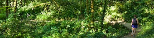
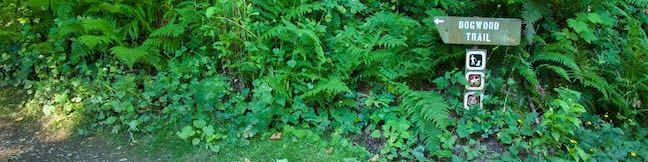
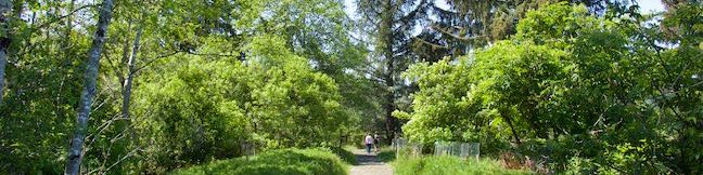
What will you find under the canopy of Forest Park? Dirt single tracks weave through verdant woodlands, passing Douglas firs and bigleaf maples bedecked with licorice ferns. Explore some of Forest Park’s charmingly ridges and ravines on this 3.5-mile loop with 510 feet of elevation change. Although Wild Cherry Trail and Alder Trail are the most notable members of this hike, this circuit actually comes together with the use of a few other trail: Leif Erikson Trail, Wildwood Trail, Keil Trail, and a sliver of Dogwood Trail. All of the junctions are well marked with obvious signs, so staying on course should be easy. Want something shorter? Dogwood Trail runs up the middle of this loop and can be used to create two other loops: Wild Cherry Trail – Dogwood Trail Loop (2.5 miles) and Dogwood Trail – Alder Trail Loop (2.8 miles).
(adsbygoogle = window.adsbygoogle || []).push({});
Wild Cherry Trail – Alder Trail Loop passes a couple trailheads along Northwest 53rd Drive. The direction here begin from the trailhead for Wild Cherry Trail, but the trailhead for Keil Trail and Wildwood Trail, which is 0.2 miles away, could be used as well (and create a slightly shorter hike). Set out from the roadside parking area along Northwest 53rd Drive, 0.9 miles from Cornell Road. Walk through a bit of grass to enter the forest. Very quickly, Wild Cherry Trail comes to a junction with Dogwood Trail where the loop gets underway. Unless you’re in a clockwise mood, stay to the right to continue strolling down Wild Cherry Trail. 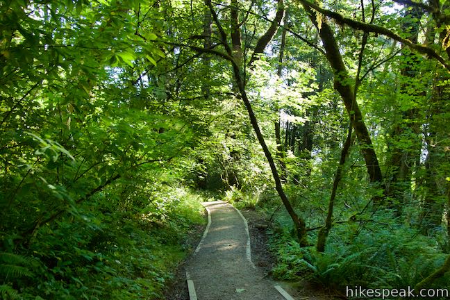
The dirt single-track goes steadily downhill through a forest of bigleaf maples, red alders, and large second-growth Douglas firs. A quarter mile from the start, swing around a bend that has a bench where you can take an early break. Continue down switchbacks to a junction with Wildwood Trail, 1/3 of a mile from the trailhead (a different section of Wildwood Trail is used later in this loop). Wild Cherry Trail does not pass straight through Wildwood Trail. Instead, you need to make a right turn on Wildwood Trail, followed by an immediate left to reach the lower section of Wild Cherry Trail. Make your way down more of Wild Cherry Trail, weaving across creases in the forest slope. Oregon grapes, impressive ferns, and plenty of native shrubs crowd the path beneath the fir trees. After 0.9 miles of hiking, come to the bottom of Wild Cherry Trail where it meets a paved stretch of Leif Erikson Drive. Turn left up Leif Erikson Drive. This road is closed to motor vehicles (but do watch out for zippy bikers). Leif Erikson Drive becomes unpaved after a quarter mile. Look to your right for glimpses through the trees over Portland and the Willamette River. If you catch the right window, Mount Hood may be visible as well (especially after some leaves have fallen from the trees). Leif Erikson Drive shifts to a dirt and gravel surface while retaining its wide path. After 0.6 miles, Leif Erikson Drive goes around a bend and passes Dogwood Trail. Stick with Leif Erikson Drive for another 0.55 miles to get to Alder Trail. (Turn left for the shorter 2.5-mile Wild Cherry Trail – Dogwood Trail Loop.) 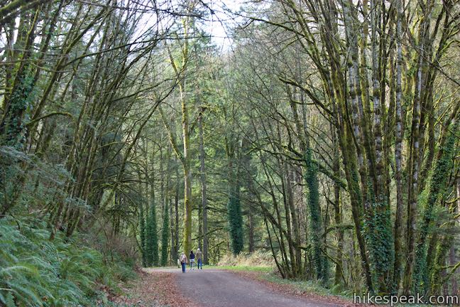
As you continue north on Leif Erikson Drive, notice the dark ledge of Columbia River basalt on the left, guarded by sworn ferns. Leif Erikson Drive curves around the back of a large draw in the terrain, crossing a branch of Alder Creek. You might expect to find Alder Trail here, but you will not. Instead, continue uphill as Leif Erikson Drive exits the draw, passing another basalt ledge. Come into the next crease in the terrain, where Alder Trail can be found, bordering a second branch of Alder Creek. The junction is marked with a plaque and trail signs. After 1.15 miles on Leif Erikson Drive, and 2.05 miles of hiking, turn left up Alder Trail. 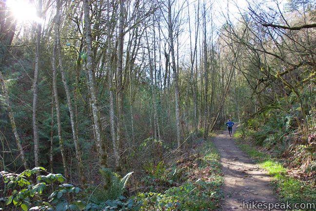
Hike uphill on Alder Trail beside a narrow, tumbling creek. Curve left across the creek after 1/8 of a mile. Alder Trail and Alder Creek are appropriately named because red alders are abundant. Splotchy lichens run up and down their stalky gray trunks. Bigleaf maples line the trail too, hosting mossy tapestries of licorice ferns. 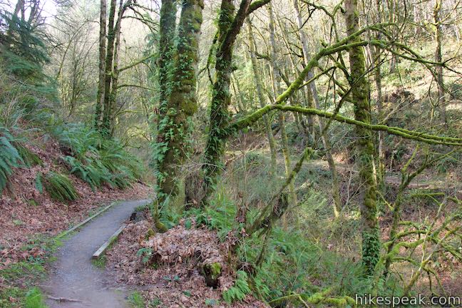
Alder Trail rises higher into the into the forest. The dirt single track crosses a tiny branch of Alder Creek as it continues its course up the wooded slope. Alder Trail appears to get less foot traffic than surrounding Forest Park trails, so take your time to enjoy the quiet natural setting. Alder Trail comes to an end after 0.85 miles, hitting a T-junction with Wildwood Trail. Turn left and follow Wildwood Trail on a fairly level path that weaves around dips and draws in the terrain. The short slopes above this trail allow extra sunlight to access the lovely forest along the trail. 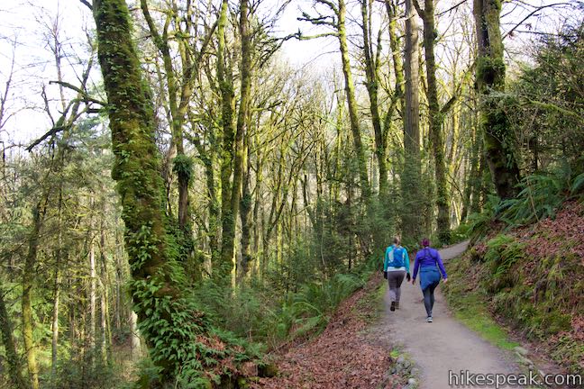
After 0.3 miles on Wildwood Trail, come to junction with the bottom of Keil Trail, just below Northwest 53rd Drive. Vehicles parked along the road will be visible from the junction. Instead of walking back along the road or letting Wildwood Trail lead you down into the forest, angle right (between Wildwood Trail and the road) to make your way up Keil Trail. Because of the way the junction is laid out, you’ll make sort of a right-left to get onto Keil Trail. The signs should be clear. Keil Trail ventures up a hill, leading into the forest at the high point of the loop. This trail is named after William Keil, who was a Forest Park forester in the 1950s. After a 0.2-mile ascent, come to a junction with Dogwood Trail, a tenth of a mile from the finish line. Bear right (to avoid following Dogwood Trail down to Leif Erikson Drive) and take the short end of Dogwood Trail over to Wild Cherry Trail. This completes the loop. Bear right again to return to the trailhead along Northwest 53rd Drive. The basic directions for Wild Cherry Trail – Dogwood Trail Loop are:
(adsbygoogle = window.adsbygoogle || []).push({});
Combine Wild Cherry Trail, Leif Erikson Trail, Alder Trail, Wildwood Trail, Keil Trail, and Dogwood Trail to make your way around this 3.5-mile circuit. Dogs are welcome on this hike, but bikes are not allowed on any trails other than Leif Erikson Drive. No fee or permit is required to hike Wild Cherry Trail – Alder Trail Loop in Forest Park, so get out and enjoy! To get to the trailhead: From Interstate 405 in downtown Portland, take exit 3 to head west on Route 30. Drive about half a mile to the first exit for Vaughn Street. The offramp passes over the top of Route 30 and merges with Vaughn Street. Drive a couple blocks west and turn left onto NW 25th Avenue. Drive half a mile south and turn right onto NW Lovejoy Street. In 400 feet, bear right onto Cornell Road. Drive 1.9 miles up Cornell Road and turn right up NW 53rd Drive. Go 0.9 miles up this road and park in one of the spaces on the right in front of the trailhead. A log fence borders the roadside parking. The trailhead is just before a curve to the left in the road and comes after the parking for Birch Trail and before the parking for Keil Trail and Wildwood Trail. Trailhead address: Dogwood Trailhead, Northwest 53rd Drive, Portland, OR 97210 from https://www.hikespeak.com/trails/wild-cherry-trail-alder-trail-hike-forest-park/
Looking for a Forest Park hike that can be completed in about an hour? Delve into the woods on this 2.5-mile loop that explores a soothing swath of Forest Park. The loop has 475 feet of elevation change, traveling downhill from NW 53rd Drive on Wild Cherry Trail before rising back up Dogwood Trail.
(adsbygoogle = window.adsbygoogle || []).push({});
Wild Cherry Trail – Dogwood Trail Loop starts from one of the roadside parking area along NW 53rd Drive, 0.9 miles from Cornell Road. Walk through a bit of grass to enter the forest on Wild Cherry Trail. Before you know it, you will come to a junction where the loop gets underway. Dogwood Trail parts to the left, which will be this loop’s return route (unless you prefer to make the circuit in a clockwise direction). Stay to the right to continue strolling down Wild Cherry Trail. The dirt single-track has a steady downhill grade that is just a bit steeper than gradual. Slip through a forest of bigleaf maples, red alders and some rather large second-growth Douglas firs. As you swing around a bend, a quarter mile from the start, pass a bench that provides a decent place to take a break and listen to songbirds chattering throughout the understory. 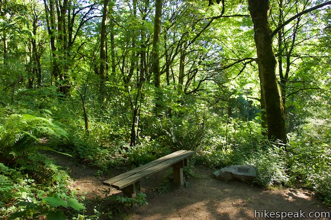
Continue down switchbacks to a junction with Wildwood Trail, which intersects both Wild Cherry Trail and Dogwood Trail (and sounds like a portmanteau of the two). Wildwood Trail could be used to truncate this loop by nearly a mile. Wild Cherry Trail does not pass straight through Wildwood Trail. Instead, you need to make a right turn on Wildwood Trail, followed by an immediate left onto the lower section of Wild Cherry Trail. This split junction is 1/3 of a mile from the trailhead. Make your way down to the next (longer) stretch of Wild Cherry Trail, weaving across creases in the forest slope. Ferns, Oregon grapes, and native shrubs crowd the path beneath the fir trees (pesky English ivy is preset too, of course). 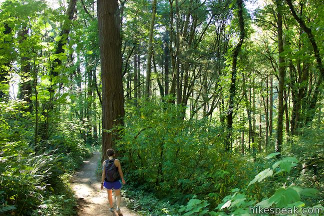
Don’t be too disheartened when you come to the bottom of Wild Cherry Trail, after 0.9 miles of hiking, and meet a paved stretch of Leif Erikson Drive. This road is closed to motor vehicles (but do watch out for zippy bikers) and you’ll be rid of the pavement in another quarter mile. Turn left up Leif Erikson Drive. You’ve crossed the low point of the loop and have a gradual ascent ahead. About halfway to Dogwood Trail, Leif Erikson Drive shifts to a dirt and gravel surface while retaining its wide path. Along the way, look to your right for glimpses through the trees over Portland and the Willamette River. If you catch the right window, Mount Hood may be visible as well (especially after some leaves have fallen from the trees). 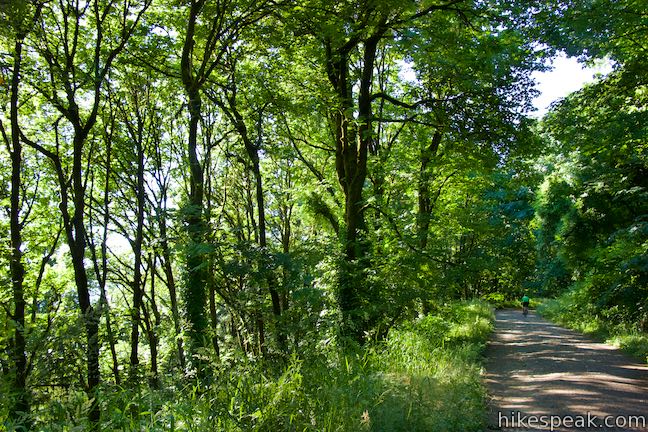
Leave Leif Erikson Drive after 0.6 miles and make a sharp left turn up Dogwood Trail. This will be the first intersection you cross. Note: if you reach Alder Trail, you hiked 0.55 miles too far on Leif Erikson Drive. Also note: by hiking up Alder Trail instead of Dogwood Trail, you can extend this loop from 2.5 miles to 3.5 miles. More details are provided below. Begin up Dogwood Trail, starting the last mile of the hike. Does the forest along Dogwood Trail look even nicer than it did along Wild Cherry Trail? It’s hard to say, but the licorice ferns climbing up the mossy bigleaf maples do seem to be just a bit fernier. During spring months, thimbleberry, trillium, and woodland violets add flowers to the greenery. Weave your way up ridge, climbing 200 feet in 0.35 miles on the lowest section of Dogwood Trail. Come to a junction with Wildwood Trail and cross through it to proceed up Dogwood Trail. The dirt trail continues to rise at a stead rate, going up the round spine of a forest ridge. After a pair of switchback bends, the grade tapers out. The dense forest may thin just enough for you to catch another glimpse over Northwest Portland. 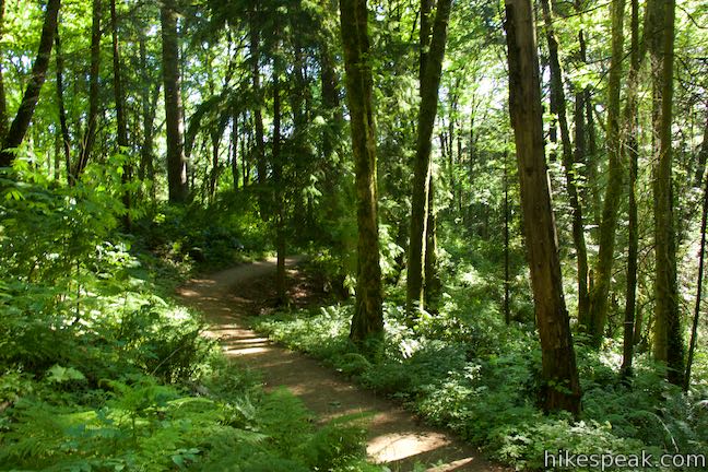
(adsbygoogle = window.adsbygoogle || []).push({});
If you find yourself wondering, “did the trail stop climbing?” It has. The trail crests and angles slightly downhill to approach a junction with Keil Trail. There’s just a tenth of a mile to go! Turn left at this T-junction to stay on Dogwood Trail, which gradually descends to the junction with Wild Cherry Trail. Close the loop, turn right, and walk 50 yards back up to the trailhead along NW 53rd Drive. The Forest Park loop on Wild Cherry Trail, Leif Erikson Drive, and Dogwood Trail is complete! Dogs are welcome on this hike but bikes are not allowed (bicycles are only allowed on Leif Erikson Drive, but not on Wild Cherry Trail or Dogwood Trail). No permit or fee is required to hike in Forest Park, so get out and enjoy! The basic directions for Wild Cherry Trail – Dogwood Trail Loop are:
Longer option: This hike can be extended by one mile by using Alder Trail instead of Dogwood Trail. For this variation, continue on Leif Erikson Drive past the bottom of Dogwood Trail for another 0.55 miles. Turn left up Alder Trail and hike 0.85 miles to Wildwood Trail. Turn left and take Wildwood Trail for 0.3 miles over to a junction with Keil Trail just below a trailhead on SW 53rd Drive. Angle right and hike 0.2 miles up Keil Trail to Dogwood Trail. Bear right, hike 0.05 miles over to Wild Cherry Trail, and turn right to hike the final 0.05 miles up to the trailhead. For other nearby hikes, check out Dogwood Trail – Alder Trail Loop, Holman Lane – Wildwood Trail – Birch Trail Loop, and Lower Macleay Trail to the Stone House (Witch’s Castle) To get to the trailhead: From Interstate 405 in downtown Portland, take exit 3 to head west on Route 30. Drive about half a mile to the first exit for Vaughn Street. The offramp passes over the top of Route 30 and merges with Vaughn Street. Drive a couple blocks west and turn left onto NW 25th Avenue. Drive half a mile south and turn right onto NW Lovejoy Street. In 400 feet, bear right onto Cornell Road. Drive 1.9 miles up Cornell Road and turn right up NW 53rd Drive. Go 0.9 miles up this road and park in one of the spaces on the right in front of the trailhead. A log fence borders the roadside parking. The trailhead is just before a curve to the left in the road and comes after the parking for Birch Trail and before the parking for Keil Trail and Wildwood Trail. Trailhead address: Dogwood Trailhead, Northwest 53rd Drive, Portland, OR 97210 from https://www.hikespeak.com/trails/wild-cherry-dogwood-loop-hike-forest-park-portland/
Just south of Lincoln City on the Oregon coast, Highway 101 crosses the Siletz River as it flows into Siletz Bay and the Pacific Ocean. It is at this location that you will find Alder Island Nature Trail, which opened in 2017 and offers a level 0.85-mile loop hike around an island between the river and its marshes. While it might lack the ocean views of surrounding coastal hikes, Alder Island Nature Trail is a tranquil spot for a short, easy outing with wildlife-viewing opportunities. 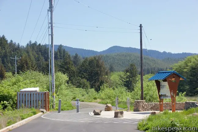
(adsbygoogle = window.adsbygoogle || []).push({});
Set out from a trailhead parking area for Siletz Bay National Wildlife Refuge, located just off Highway 101. From the trail kiosk, set out northeast on the paved service road extending off the end of Millport Slough Lane. Enjoy views east over wetlands along the Siletz River. Canoes and kayaks (and other non-motorized boats) are welcome to explore the refuge too, using a boat launch near the trailhead. As you walk along the road, gaze over a channel cut through the marsh on the right. When this area became a National Wildlife Refuge in the 1990s, efforts were made to return the bay to a more natural state. A panel at the trailhead explains:
(Anadromous fish are those that travel up rivers from the ocean to spawn.) Alder Island also has a unique development history. A nearby housing construction project dumped dirt from a dredging operation onto the island, raising Alder Island above the tides and allowing alder trees to take root. The island’s man-made height was retained during the refuge rehabilitation so that the island could host a hiking trail. 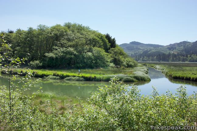
Approach the end of the pavement, around 0.15 miles from the trailhead. Bear right onto a gravel path, Alder Island Nature Trail. Cross a land-bridge over the channel along the west edge of Alder Island. On the other side, come to a marked trail junction where the loop begins. To the left, the trail angles toward Siletz River. For now, continue straight ahead and save the sights of the river for the second half of the hike (unless you prefer to hike in a clockwise direction instead). Alder Island Nature Trail proceeds along a channel the flows beside the island. Keep an eye on the banks to spot herons, egrets, and ducks. Pine-covered hills rise beyond the wetlands. The trail weaves through stands of alders that do more than give this island its name, presenting hikers with pleasant partial shade. Horsetail, ferns, and grasses soak up the speckled sunlight that reaches the ground. 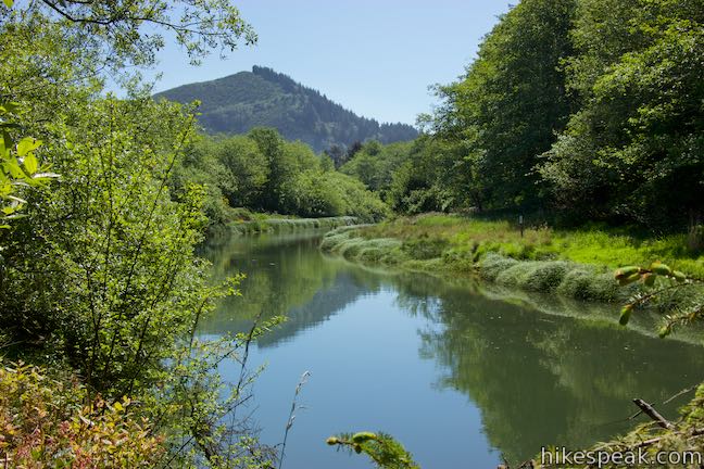
After 0.4 miles of hiking, reach the east end of the island, where the trail makes a sharp right turn. A bench positioned here offers nice views looking up and across the Siletz River. Have a seat and listed to songbirds in the trees. Step up to the shoreline to broaden your perspectives of the river. The shore here may also serve as an access point for anglers. 
Continue on the trail across the north side of the island. Over the second half of the loop, river views are abundant from the edge of the island’s forest. Eventually, the trail curves away from the river and borders a channel flowing along the island. Gaze down the Siletz River toward a bridge on Highway 101, backed by Siletz Bay.
(adsbygoogle = window.adsbygoogle || []).push({});
Walk along the channel back to the junction where the loop began. Having hiked 2/3 of a mile, it is now a short walk back to the trailhead. Bear right, leave the island, and turn left when you hit the pavement to return to your vehicle. With just a few feet of elevation change along this 0.85-mile loop, you’re unlikely to find an easier hike along the Oregon coast between Lincoln City and Depot Bay. Put some coffee or tea in the thermos and enjoy a stroll on Alder Island! Dogs and bikes are not allowed on Alder Island Nature Trail. No fee or permit is required for this hike in Siletz Bay National Wildlife Refuge, so get out and enjoy! To get to the trailhead: From Lincoln City, take Highway 101 south for 5 miles. Pass Route 229 on the left and drive another half mile, crossing over the Siletz River. Turn left onto Millport Slough Lane, following signs for Siletz Bay National Wildlife Refuge. Drive a hundred yards to the trailhead parking area. Coming from Depoe Bay, drive 7 miles north on Highway 101. After Siletz Bay appears, turn right onto Millport Slough Lane and park near the trailhead at road’s end. An intersection on the right side of Highway 101 with Immonen Road comes half a mile before Millport Slough Lane. Trailhead address: Millport Slough Lane, Lincoln City, OR 97367 from https://www.hikespeak.com/trails/alder-island-hike-siletz-bay-lincoln-city/
Most of the trails in Columbia River Gorge lead to big waterfalls or big views, but one of these trails is not like the others. The Pipeline Trail near downtown Hood River has a hiking experience that could very well be a one-of-a-kind. This route exchanges the average dirt trail for a catwalk built on top of a penstock pipeline. That catwalk stands a dozen feet off the ground and whisks visitors through tree branches to raised views of Hood River. The distinct hike on Hood River Pipeline Trail is easy too, at 2.8 miles round trip with just 100 feet of elevation change. The Power of Hood RiverHood River flows some 25 miles from the slopes of Mount Hood to the shores of the Columbia River. Along the way, the water nourishes Hood River Valley and creates a scenic alley for this unique hike.
(adsbygoogle = window.adsbygoogle || []).push({});
For much of the 20th century, Powerdale Dam regulated the flow of the river and delivered water, via a long pipeline, to the Powerdale Substation, where hydroelectric energy was produced for the city of Hood River. More recently, the dam and powerhouse were decommissioned. About half a mile of the pipe was removed to restore the area, and flooding wiped out other stretches of the pipeline. Fortunately, about 2/3 of a mile of the pipeline remain in place, including a bridge across Hood River. Also intact is a catwalk going across the top of the pipeline, previously used to service the flowline for the substation, but now maintained just for public enjoyment. Hiking Pipeline TrailHalf a mile from Interstate 84, find a short, old road dropping from Highway 35 to a trailhead parking area beside the now defunct Powerdale Substation. Overlook the paths wandering north toward a trestle bridge across the Hood River and begin on the established trail. Go around the gate and hike southwest. The wide and level dirt trail passes alongside a clearing below a wooded slope. Poison oak hides below blackberry brambles on the left. Spot the sealed end of a steel pipeline, which disappears into the ground as you go up a short slope alongside the pipe. Cross a line of railroad tracks and bear left, bordering another section of pipeline between the tracks and the river. You can even walk on top of this pipeline if you like, to get a taste of things to come. (While surrounding pipeline was removed, this stretch was probably left in place to avoid disturbing the rail line). 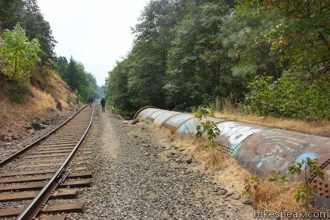
Walk up a path along the west side of the train tracks. After 0.15 miles along the tracks, and about 1/3 of a mile from the start, follow the trail as it bears right through some short brush, parting from the railroad tracks. Although the trail remains parallel to the rail line, it gets closer to the river and the scenery improves. Look across Hood River. The tumbling water is backed by trees rising up a steep bank toward Hood River homes. Between the river-lining alders, find patches of blackberries that ripen in August (boasting delicious jammy flavors). The leisurely walk along the river traces the old route of the pipeline. Pass some concrete supports that remain after the pipeline was removed. Eventually, the trail goes up a short slope and comes to a junction. Avoid the trail on the left that heads across the railroad tracks. Do the obvious thing by staying to the right along the trail. In less than a hundred yards, come to a bridge where the catwalk adventure begins. The pipeline reveals itself, coming out from underneath the trail. Ahead, the pipeline runs right up the center of a steel bridge. Since the catwalk is on top of the pipeline, it crosses over the top of the bridge. This route has commanding river views (and the catwalk has handrails on both sides for safety). 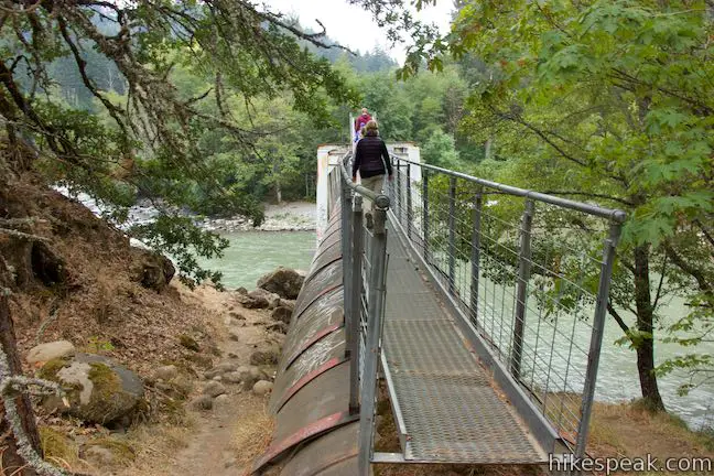
On the CatwalkTake the catwalk across the bridge, enjoying perspectives up and down Hood River. A pool just upriver from the bridge looks appealing for fishing and the riverbanks have plenty of picnic potential. Having walked on dirt trail for the first 0.8 miles, the next 0.6 miles of the hike stay on the gangway. On the far side of the bridge, spot a service ladder on the right, which could be used to get down to river level. Pass through a gate and continue on the catwalk on top of the pipeline. The catwalk puts you about a dozen feet above the ground, up into trees whose branches sometimes encroach on the trail. Feel what it is like to walk through the trees on this canopy-crossing catwalk! The catwalk was used to by PacifiCorp to service the pipeline between the Powerdale dam and substation. Look down on the pipeline as you go and notice that some sections are made of steel, while other sections of the penstock pipeline are assembled from wood staves and rusty bands. This construction dates back to the 1920s. A major flood in November of 2006 destroyed sections of the pipeline. Prior to that, the pipeline below the catwalk still had water flowing through it. In an area of the pipeline nicknamed the “rainbow garden” water sprayed out of leaks in the pipe in impressive bursts. The pipeline no longer carries water, so there’s no chance of getting sprayed on the catwalk. 
(adsbygoogle = window.adsbygoogle || []).push({});
Handrails run all along the sides of the catwalk to keep you on course. The handrails are in fine working order despite a few sections that appear to have been bent by fallen tree limbs. The walkway itself shows a few signs of disrepair, so pay some attention to your footing along this otherwise easy path. Proceed up the catwalk like a breeze through the forest. The steep bank of the canyon rises to the right and Hood River sweeps in and out of view to the left. The pipeline runs along the shoreline for a stretch and the catwalk provides nice vantages across rapids in the river toward more forest. The railroad line is visible on the far bank. The mostly-level catwalk tackles one slope as the pipeline rises into more forest. 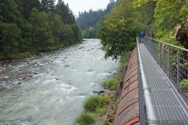
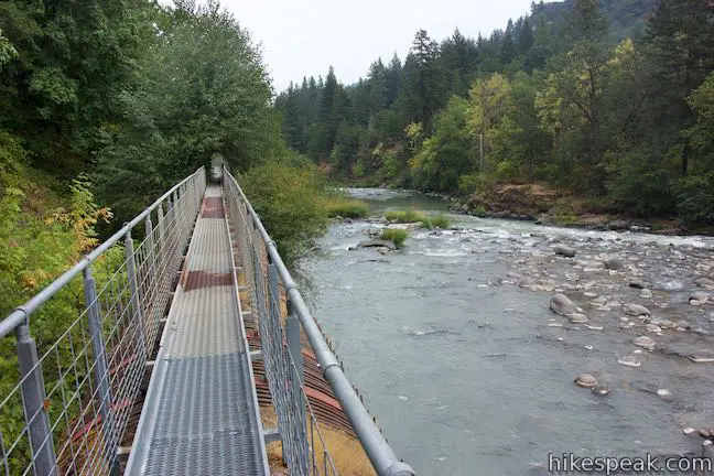
When the river comes into view again, the pipeline approaches a sweeping bend. As you absorb the upriver views, the catwalk comes to an abrupt ending. In front of you, the rest of the pipeline is suddenly missing, having been destroyed by the 2006 flood. Unfortunately, the fun ends here and it is not possible to go one step farther. Some of the old supports for the pipeline are still visible beside the river, allowing you to imagine the route of the old flowline. Take in this fine perspective of Hood River, before turning around and walking back down the pipeline. This hike is 2.8 miles round trip with 100 feet of elevation change. While the dirt trail for the opening 0.8 miles of the hike is not marked, it is easy to follow. The 0.6 miles of catwalk trail are straight forward, with no junctions that could lead hikers astray. 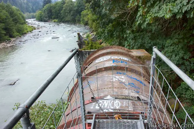
Hood River Penstock Flume Pipeline Trail is a memorable and enjoyable outing. In addition to being unique – Where else can you walk on a catwalk on top of an old pipeline? – the trail offers passage through a scenic stretch of Hood River that might otherwise be inaccessible. Other than a kiosk for the Powerdale Corridor Conservation Lands, the trailhead does not have any amenities (no bathrooms). Camping and overnight parking are prohibited. This trail is not appropriate for dogs or bikes. Parking at the trailhead is free and no permit is required for this hike, so get out and enjoy! To get to the trailhead: Take Interstate 84 to downtown Hood River. Get off at exit 64, following signs for Oregon 35 (Mount Hood Highway). At the end of the offramp, turns south on Oregon 35 toward Government Camp and Mount Hood (do not go north toward Hood River Bridge and White Salmon). After 1/3 of a mile, go through an intersection with Route 30 and Old Columbia River Drive. Drive another 0.2 miles and make the next right down Powerdale Road, which is unmarked. Slip through the open gate at the top and drive 0.2 miles down this pitted paved road to a parking area at road’s end where the hike begins. Trailhead address: Powerdale Road, Hood River, OR 97031 from https://www.hikespeak.com/trails/hood-river-penstock-flume-pipeline-trail/
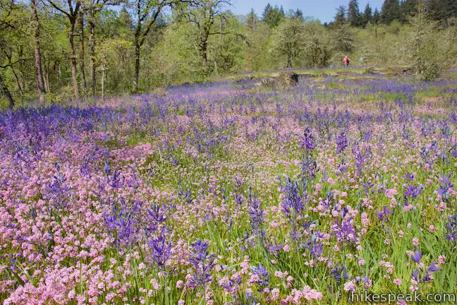
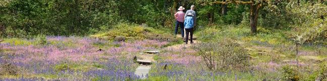
Camassia Natural Area contains something special – one of the best wildflower displays in the greater Portland area. From April to May, the grassy plateaus in this 27-acre preserve boasts beautiful purples, blues, pinks and yellows created by Camas lilies, blue-eyed Mary, rosy plectritis, and buttercups (as well as other flowers). Explore this West Linn jewel on an easy 0.8-mile loop through colorful meadows and mellow forests.
(adsbygoogle = window.adsbygoogle || []).push({});
Camassia Natural Area (also known as Camassia Nature Preserve) is named after the Camas lily, or common camas, which blooms abundantly in the park’s plateaus. The Nature Conservancy acquired this land in 1962 and in the decades since, they have removed invasive species, encouraged native growth, and added wood chip and boardwalk paths for visitors. Camassia Natural Area has a few access points, but the easiest place to enter the park is from the end of Walnut Street, a short distance off Interstate 205. A path from road’s end enters the park and immediately comes to a split in front of a trail kiosk where the Loop Trail begins. The loop is just as lovely in either direction. If you pick up a trail guide at the kiosk, it is best to begin on the trail to the left so that the entries in the guide can be read in ascending order. Take the trail to the left to head up the west side of the loop, leaving the neighborhood for a partially-shaded woodland. The first entry in the guide explains that this “forested wetland restoration site” was (like too many other forests around Portland) covered in English ivy before volunteers cleared out the ivy to foster a healthy environment for natives. After a hundred yards of walking, pass a path that rises to the left and stay on what is obviously the main trail to the right. The path goes up to Windsor Terrace in the neighborhood to the west. Just after that, come to a junction with a path on the right that goes over to a small pond in the center of the park. During spring visits, when the wildflowers are at their peak, the pond is likely to be overflowing into the surrounding wetlands. The spur path dead ends near the swampy pond after a hundred yards. Although the pond itself is not a great attraction, a hearty collection of trillium bloom along the short path to the pond, making it an enjoyable side-excursion. 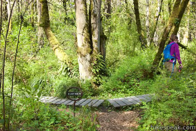
Loop Trail continues through the forest, rising toward the edge of a long meadow, also referred to as an herbaceous bald. Hit another junction, 1/8 of a mile from the start. To the left, a connector trail rises toward Windsor Terrace (a nearby street) and Wilderness Park (a protected forest to the northwest). To maximize the wildflower viewing on your hike, venture a hundred yards off the loop, taking Wilderness Park Connector Trail up one little switchback to a slightly elevated field of wildflowers. Turn around when the trail enters the forest. This pocket meadow has no shortage of wildflowers. Two-toned beauties called blue-eyed Mary are abundant, contrasted by the bright yellow of buttercups. 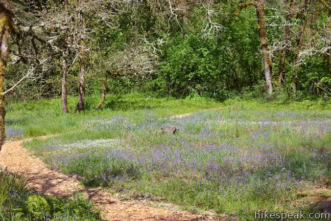
Return to the Loop Trail and proceed east into a much larger meadow, which is probably the most spectacular part of the park. Camas lilies explode out of the grasses like fireworks on stalks, with purple petals bursting around yellow stamens. The blooms of rosy plectritis cheer them on, carpeting the field in flowers that look like pink pom-poms. 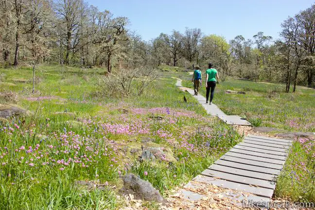
Meander across the meadow, which is wrapped by the twisted, lichen-covered branches of Oregon white oak. Obviously, don’t venture off the boardwalk and pathway through this fragile environment. At the east end of the meadow, a viewpoint on the right offers a perspective over the park’s pond. 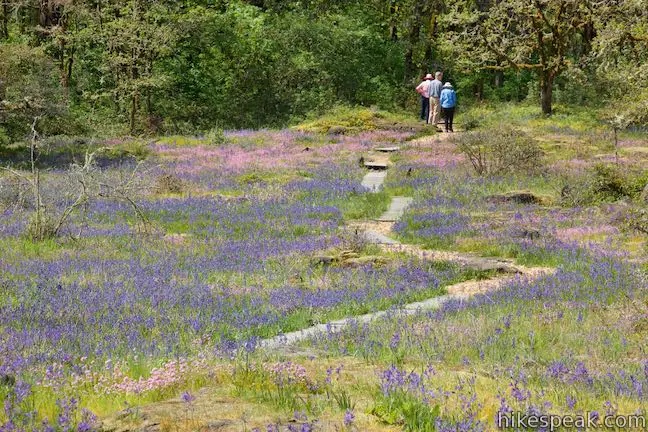
Just a tenth of a mile past the trail to Wilderness Park, Loop Trail reaches another marked junction with a second side trail worth exploring. The trail to the left ventures over a rise and down into forest on the way to West Linn High School. To see a lot of extra wildflowers, stray fifty yards up this trail and then turn around before it drops into the trees. Colorful rosy plectritis and Camas lilies seem to grow on top of each other in the southward sloping meadow near the junction. 
Continue to the right on the Loop Trail, easing through some oaks into another meadow. Mossy boulders and bedrock break up the flowering grasses, providing a window into the geologic history that created this blossoming environment. An entry in the trail guides, sums up the park’s past:
Come down the trail to a split. To the left, a short spur ventures out to the edge of a basalt ledge. Look across a grassy dip toward a ridge with a cell tower on it than has been the home of an osprey nest since 1997. On the left side of your perch is a tall Pacific madrone tree, which has red-orange bark that stands out from other members of the forest. Continue down the Loop Trail through more great wildflower beds in Camassia Natural Area. A series of grassy rock-wrapped plots contain different mixed of wildflowers. 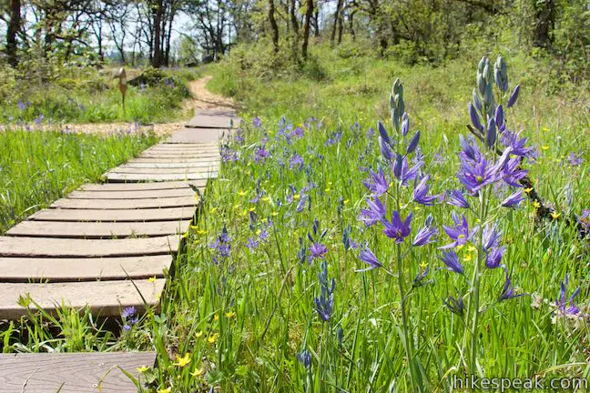
(adsbygoogle = window.adsbygoogle || []).push({});
As the trail bellies out and begins to rise, come to one more park highlight. At 0.2 miles from the High School Trail junction, pass a viewpoint on the left. Look east toward Mount Hood. This giant 11,249-foot snow-covered mountain (Oregon’s tallest) usually looks best when it is lit from the west by the afternoon light. Over the final 0.2 miles, the Loop Trail passes through small meadows and returns to the forest. These meadows were heavily restored by The Nature Conservancy to remove invasive plants and shrubs and reintroduce native wildflowers and grasses. Grab a bit of shade as you return to the trail kiosk where the loop began. Bear left to make your way back to Walnut Street to complete this 0.8-mile loop hike with a couple spurs and 70 feet of elevation change. Dogs and bikes are not allowed on this outing. No fee or permit is required to hike the Loop Trail through Camassia Natural Area, so get out and enjoy!
To get to the trailhead: Take Interstate 205 to the west side of the Willamette River, 12.5 miles south of the merger with Interstate 84 and 7.5 miles east of Interstate 5. Take exit 8 for State Route 43 (signs for West Linn and Lake Oswego). At the end of the offramp, head south toward Oregon City (this will be a left turn for those traveling south on I-205 and a right turn for those coming from I-5). At the first intersection, where the road splits, bear right up Willamette Falls Drive. After a curve to the left, and 0.3 miles on Willamette Falls Drive, bear right up Sunset Drive. Cross over I-205 and make the first right onto Walnut Street. Drive two blocks to the trailhead at the end of the road and park where available. Trailhead address: 4800 Walnut Street, West Linn, OR 97068 from https://www.hikespeak.com/trails/camassia-natural-area-wildflower-hike-west-linn/ |


 RSS Feed
